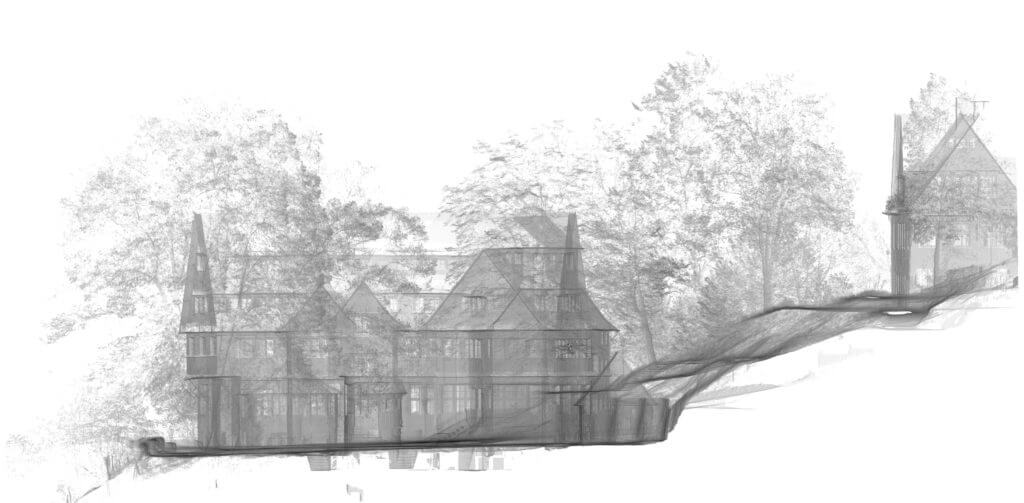
What is point cloud?
A 3D point cloud is a 3D data record made from individual points in a three-dimensional coordinate system, which is usually defined by X, Y and Z coordinates. The first step in creating a point cloud involves flying over a terrain or object in order to capture the raw material (images or raw point cloud) from LiDAR [laser] scanners. The data is processed, registered, if necessary edited and then evaluated in the later sequences of the workflow. Then there is further processing of the image material using special software to generate the final, usually georeferenced, point cloud. Point clouds are used in a wide variety of application areas. For example, they can be used for depicting surfaces, structures, terrain and objects, used for documentation purposes or used for further processing in, for example, CAD, BIM or 3D rendering software for 3D modelling or 3D visualisation.
The point cloud as a result or as a data basis for evaluation
The point cloud is already the result of a 3D measurement or 3D survey. Dimensions (X, Y and Z) can be deduced and paths measured, amongst other things, directly from a point cloud. If there is a reference to a coordinate system in measurement data (georeferencing), this is of course adopted in the point cloud and the data derived from it. The point cloud also serves as a data basis for evaluation and digital enhancement; e,g, modelling and volume calculation. In this case, the point cloud constitutes a detailed design foundation for CAD applications or mesh (wireframe) processing.
Common point cloud formats (including laser scanner data formats):
- LAS/LAZ
- XYZ
- E57
- PLY
- PTX
- PTS
- FWS
- LSPRJ
- PTG
- RSP
- ZFS
- ZFPRJ
- MPC
Possible deductions / evaluations based on dense point clouds
- Surveying / 3D measurement
- Digital orthomosaic photos (orthophotos) (distortion-free aerial images)
- Digital terrain models
- 2D plan creation – floor plans, sections, views, roof and façade plans
- 3D CAD modelling – creation of 3D models of buildings and structures
- 3D mesh / meshing using triangulation
- Models for building information modelling, or BIM
- Data basis for geographic information systems, or GIS
- Analyses such as determining flatness, subsidence or deformation
- Documenting actual conditions, progress and changes
- Delta calculations for documentation and for target/actual comparisons
- 3D renderings and 3D visualisation – reconstructing reality
- Visualisation and monitoring – depicting actual conditions
- CGI (Computer-Generated Imagery) content
- Virtual Reality (VR) content
- Textured 360° tours, panoramas and views
