3D LASER SCANNING, MOBILE LASER SCANNING AND 3D DATA EVALUATION
Due to advancing digitalisation in all sectors of industry, the demand for 3D assets and inventory data is huge. We have expanded our service portfolio accordingly and offer various forms of laser scanning services. In addition to terrestrial 3D laser scanning, we are also specialised in mobile laser scanning. The latest LiDAR scanning systems and very stable SLAM algorithms are opening up possibilities for logging and 3D data evaluation that did not exist here before. Our aim is to log objects, buildings and locations for our customers fully and in the shortest time from the inside, outside and above. This enables a one-stop shop for flawless 3D data evaluation and transfer. We are happy to advise you on the best systems and associated services in relation to your projects.
3D LASER SCANNING, MOBILE LASER SCANNING AND 3D DATA PROCESSING SERVICE OVERVIEW
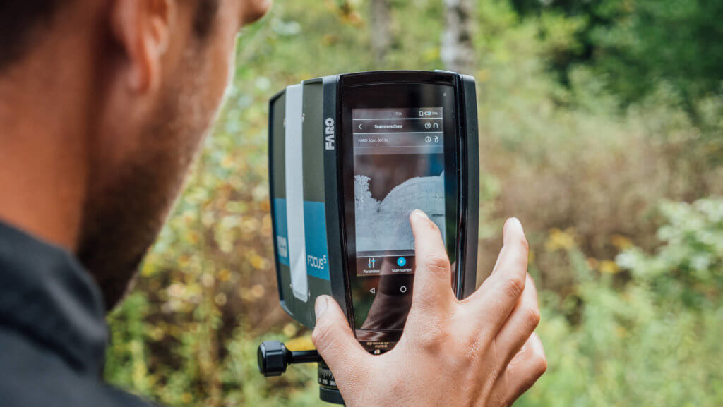
TERRESTRIAL 3D LASER SCANNING
- 3D measurement, 3D surveying and 3D inventory (greyscale and colour) using terrestrial 3D laser scanning
- Point clouds as a result of 3D surveying / 3D documentation
- Surveying for volume calculation and quantity surveying
MOBILE LASER SCANNING USING SLAM METHODS
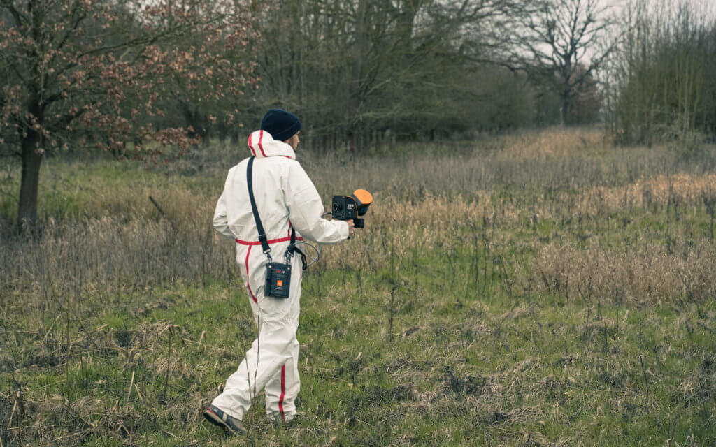
- 3D measurement / 3D surveying using mobile laser scanners
- Quick and cost-efficient 3D inventory and asset scanning in greyscale and/or in colour
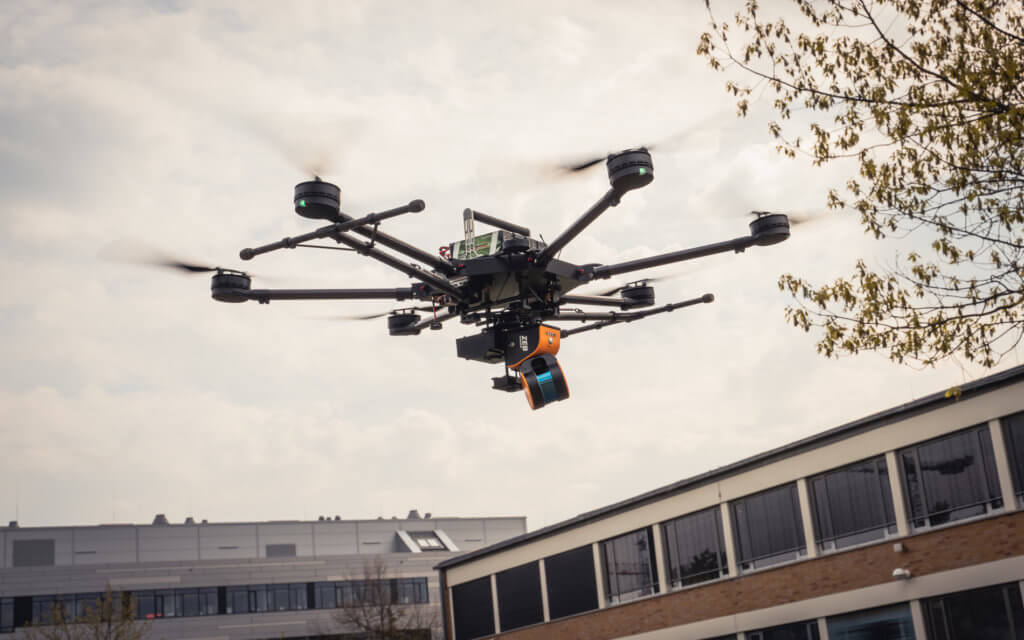
- Surveying of forest areas that are accessible on foot and by means of a mobile laser scanning system on a drone
- Point clouds as a result of 3D surveying / 3D documentation
- Surveying for volume calculation and quantity surveying
- GeoSLAM ZEB-HORIZON Scan Service
- GeoSLAM ZEB-HORIZON drone
MOBILE MAPPING BY CAR, BOAT, SHIP OR TRAIN/RAIL (THROUGH PARTNER COMPANIES UPON REQUEST)
3D DATA PROCESSING AND MODELLING
- Point cloud recording and georeferencing
- Point cloud evaluation for volume calculation and quantity surveying
- Deriving digital terrain models, including digital elevation models (DEM), digital terrain models (DTM) and digital surface models (DSM)
- 2D plans – floor plans, sections (longitudinal and cross sections), views, façade plans
- 3D models (3D CAD models)
- As-built models
- BIM (Building Information Modelling) models
- 3D mesh models
TERRESTRIAL 3D LASER SCANNING
Terrestrial 3D laser scanning is a contact-free and highly precise method of capturing and surveying objects, inner spaces and the smallest components three dimensionally. The LiDAR (light detection and ranging) measurement technology is increasingly gaining in importance and will replace traditional measurement processes in many areas to a large extent in the future. In particular, the fast speed of measurement combined with complete documentation provide a large number of benefits. Individual images procured from scans or panoramas can later be used as a reference for modelling, visualisation and also texturisation. We at LOGXON use a wide range of measuring devices from leading manufacturers. We make the right choice in coordination with you in relation to the assignment, object size and the precision to be achieved.

GEOSLAM ZEB-HORIZON SERVICE
We offer special services based on the GeoSLAM ZEB-HORIZON mobile laser scanner. We offer the complete logging of objects, including recording, processing and georeferencing, right through to modelling (full service). On the other hand, we also act simply as a flight service provider for customers possessing a GeoSLAM ZEB-HORIZON. In such instances, we take on all the tasks concerning the flying using a drone. Our service ranges from gathering all the necessary permits through to conducting the flights and raw data transfer. The customer’s laser scanner will usually be flown in this process. Use of our device for reasons of efficiency is also possible, however. In both cases data processing remains your responsibility.
MOBILE MAPPING AND GEOSLAM ZEB-HORIZON DRONE
We developed a special GeoSLAM Horizon drone which is also suitable for other mobile mapping systems and UAV lasers scanners. The drone could be also uses to carry the dotscene dotcube, Riegl laser scanners and yellowscan LiDAR systems. Further information about our LOGXON UAV name Porter can be found HERE

MOBILE LASER SCANNING USING SLAM METHODS
Like terrestrial laser scanning, mobile laser scanning is also a contact-free yet precise method of logging and surveying objects, inner spaces and the smallest components three dimensionally. The main advantage of the modern mobile laser scanning systems – based on the SLAM method – is that no GPS is required for the orientation and recording. The global recording and aligning together of the individual scans is performed using SLAM algorithms during processing on the PC. SLAM stands for Simultaneous Localisation And Mapping. Use in isolated areas, inner spaces or even underground is therefore possible without any issues. Furthermore, our mobile laser scanning system can be worn, transported or flown by drone. The scanning range of our systems is currently at 100 m and up to 600,000 scans/second are possible.

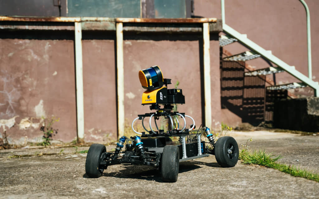
MOBILE MAPPING BY MEANS OF CAR, BOAT, SHIP OR TRAIN/RAIL (THROUGH PARTNER COMPANIES UPON REQUEST)
Through our partners we have access to a mobile mapping system, which we use for route surveys. The system is very precise, compact, light and pre-equipped with a 360° panoramic camera. Due to the design, it can be attached to a Segway, car, lorry, boat or train, for example. This makes the system extremely versatile. Even manual carrying or attaching it to the roof of a car is possible, thus setting new standards for size, mobility and versatility. The system delivers a dense point cloud, camera images and position and orientation data.
