Data logging for 3D visualisation, for 3D rendering and computer-generated imagery (CGI)
For the creation of 3D visualisations, the use of UAVs is perfectly suited for generating the required (raw) data material, such as textured point clouds, or 3D meshes derived from them, or high-resolution textures. Large 3D raw data quantities of inaccessible or large-scale areas can be captured from the air within the shortest possible time and be subjected to further digital processing. We currently use cameras in the air (photogrammetry) and LiDAR scanners in the air and on the ground for logging and capturing 3D point clouds.
Service overview for 3D visualisation, 3D rendering and computer-generated imagery (CGI):
- Raw data gathering from the air for 3D visualisation, 3D renderings and CGI
- Textured (colour) point clouds as a three-dimensional basis for reconstruction
- 3D mesh models – polygon mesh (wireframe) in a desired grid
- Textured 3D mesh models – realistic depiction of objects, cities or landscapes
- Creating large/high-resolution textures or their raw data for further processing
- Evaluating 3D point clouds: 3D modelling
- Photorealistic 3D renderings
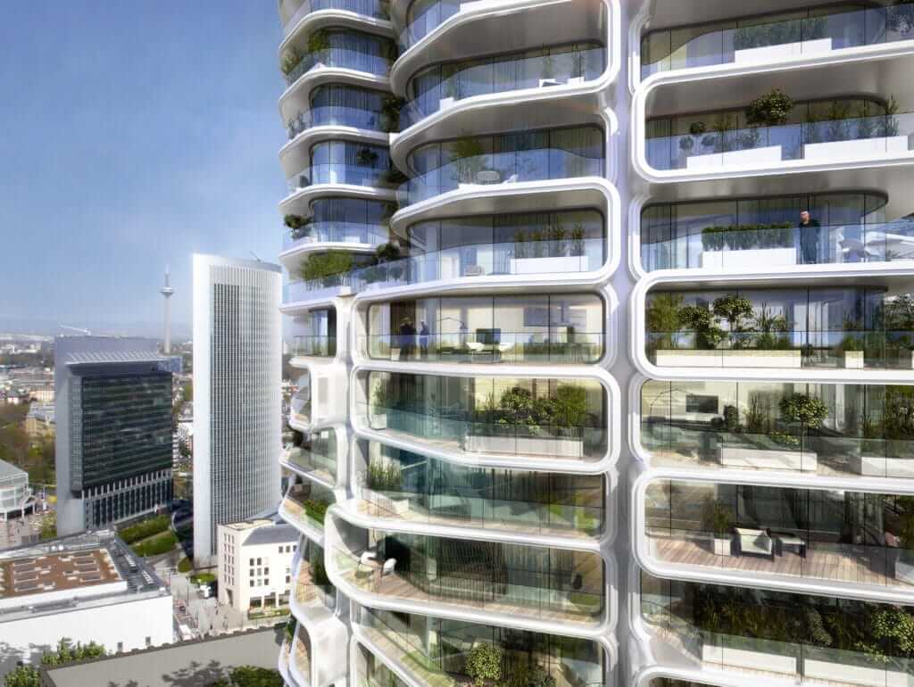
3D visualisation
3D visualisation has firmly established itself in landscape architecture, in urban and road construction, as well as in other fields. By means of 3D visualisation, well-chosen materials (textures) and light conditions, an atmosphere can be created in a highly strategic way to convey the desired mood. Furthermore, spatial qualities, proportions and visual references can be depicted realistically. We offer 3D visualisations for different applications, such as architectural visualisations, visualisations of existing conditions and bird’s-eye-view visualisations in order to make terrain, distances and references visible in an easy-to-understand manner.
3D rendering
We offer photorealistic 3D renderings for use in the fields of design, planning and sales/marketing based on point clouds, 3D models and textures. We use the latest technology, software and rendering techniques to inject life into your plans. In addition to 3D renderings, we also offer photomontages, 360° panoramas, virtual tours and animations.
CGI (computer-generated imagery) in detail
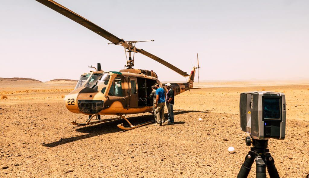
The use of UAVs is opening up whole new opportunities for gathering large data quantities within the shortest possible time to the constantly growing computer-generated imagery (CGI) sector. Wide-ranging and inaccessible areas can be flown over quickly and precisely to gather and secure the required data. Aside from large projects, drone deployment in the field of CGI also brings benefits with it as point clouds, large textures, plates, terrain scans or 360° SkyBoxes can be recorded quickly, precisely and cost-effectively. These can be used for the reconstruction of real geometric shapes in 3D or CAD software.
VFX – Visual effects
The field of VFX (visual effects) is increasingly gaining in significance in film and advertising productions. Drones can be used here effectively for capturing plates, terrain scans, 360° SkyBoxes and point clouds, for example. We are highly mobile and flexible with our drones when it comes to sensors (camera/laser) and are able to record large areas in the shortest possible time without having to step foot on them (contact-free logging). A combination of point clouds from air and ground recordings (e.g. terrestrial LiDAR laser scans) is also possible due to a high points density of the drone data.